How container vessels move around the world
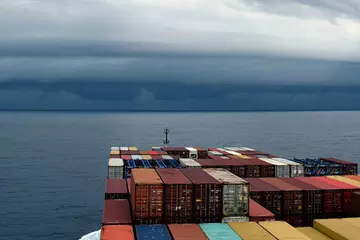
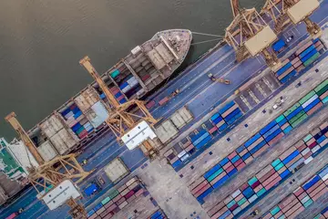
Container vessels navigate the ocean like trucks on busy highways, following specific shipping routes to and from the world’s busiest seaports. These routes support international trade by offering the fastest sailing times for ships carrying the goods we use and rely on every day. Learn about the most heavily traveled maritime lanes around the world and the freight that travels on them.
Getting to know the world’s busiest shipping lanes
These eight routes are the busiest shipping lanes for ocean cargo vessels:
The English Channel
Each day, more than 500 vessels cross the 350-mile-long English Channel — widely considered the busiest shipping lane in the world and a critical route in the European shipping network. Cargo vessels, carrying everything from oil to wheat, share the channel with passenger ferries, fishing vessels, pleasure craft and even the occasional swimmer. The body of water separates England from France and connects the North Sea and the Atlantic Ocean.
Strait of Malacca
A narrow, 580-mile stretch of water between the Malay Peninsula and the Indonesian island of Sumatra, the Strait of Malacca is the shortest sea route between India and China. It’s one of the most heavily traveled shipping channels in the world and is a major route for oil transport and goods like Indonesian coffee, coal and liquified natural gas.
Panama Canal
Completed in 1914, the Panama Canal is ranked as one of the seven wonders of the modern world by the American Society of Civil Engineers. It’s one of the most important international waterways, with more than 14,000 ships navigating it each year. The canal uses a system of three locks to raise the elevation of ships so they can travel across Gatun Lake (which is 85 feet above sea level) to reach the Pacific Ocean, a process that takes 8-10 hours. In comparison, bypassing the canal and traveling around Cape Horn at the southern tip of South America would take 2 weeks.
A $5.4 billion expansion in 2016 added a new lane of traffic to the Panama Canal, doubling its capacity and increasing the width and depth of the lanes and locks. It can now accommodate vessels carrying up to 14,000 TEUs (twenty-foot equivalent units).
Suez Canal
Providing the fastest crossing from the Atlantic Ocean to the Indian Ocean, the Suez Canal in Egypt is one of the world’s most heavily used shipping lanes. It was completed in 1869 and is the first canal that directly links the Mediterranean Sea to the Red Sea. Because the narrow passage can’t support two-way lanes, a trip through the 120-mile-long Suez Canal takes about 16 hours, with an average of 100 vessels completing the crossing each day.
Bosphorus Strait
Also known as the Strait of Istanbul, this narrow, natural strait in northwestern Turkey is 19 miles long and links the Black Sea with the world’s oceans. It’s one of the most important routes for transporting oil to regions including Asia and Western and Southern Europe. An estimated 48,000 ships move through the Bosphorus Strait each year.
Strait of Hormuz
The Strait of Hormuz is located in the waters of Iran and Oman in the Persian Gulf. Roughly 21 million barrels (or about one-third) of the world’s sea-traded oil passes through the strait every day, headed primarily to Asian markets like India, China, Japan, Singapore and South Korea.
Because it is just 21 miles wide at its narrowest point, ships moving through the strait are required to stay in separate inbound and outbound lanes, with a two-mile “median” or buffer zone between them as a safety measure.
The Danish Straits
With approximately 70,000 ships moving through them each year, the Danish Straits are some of the most trafficked channels in the world. They’re made up of a system of three channels — the Oresund, the Great Belt and the Little Belt — that interlink the North Sea and Baltic Sea, and they provide a key pathway for oil shipping between Russia and Europe. The widest channel, the Great Belt, is the primary passage for large vessels.
St. Lawrence Seaway
Extending more than 2,300 miles from the Atlantic Ocean through Canada to the head of the Great Lakes, the St. Lawrence Seaway — also called “Highway H2O” — serves as a critical North American trade route. It was built in 1959 as a binational partnership between Canada and the U.S. and continues to operate that way.
The St. Lawrence Seaway is not a single waterway; it’s a system of locks, channels and canals extending from Montreal, Quebec to Lake Erie. It connects to more than 100 ports and commercial docks within the eight Great Lakes states, as well as the Canadian provinces of Ontario and Quebec. It’s also a critical network for transporting goods between North America and 60 overseas markets, with more than 160 million metric tons of general cargo moving across the seaway each year.
Need to ship freight?
Learn more about ArcBest ocean shipping services. Or check out our blog for more articles about global shipping.


